

Introduction
A world of hidden mysteries and important data lurks beneath the dazzling surface of our seas, lakes, and rivers. Understanding these underwater landscapes is critical for environmental protection, resource management, and catastrophe preparedness. Bathymetric LiDAR drones, with their cutting-edge technology, have emerged as invaluable tools in this endeavor.
In this blog, we'll dive deep into the environmental benefits of bathymetric LiDAR drones and how they are helping protect our planet's aquatic ecosystems.
Unveiling the Depths
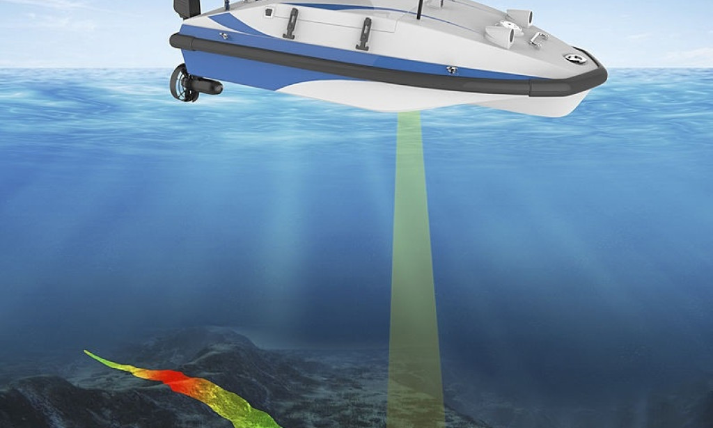
Before we explore the advantages, let's take a moment to understand what bathymetric LiDAR drones are. Bathymetric LiDAR, or Light Detection and Ranging, is a technology that uses laser pulses to measure distances underwater. When mounted on drones, these systems can create detailed 3D maps of underwater terrains with remarkable precision.
1. Conservation of Aquatic Habitats
One of the foremost environmental benefits of bathymetric LiDAR drones is their role in preserving aquatic habitats. By mapping the topography of the seafloor and lake beds, researchers and conservationists can identify sensitive ecosystems. These tools help in designating protected areas, which is crucial for safeguarding the diverse marine life that resides there.
2. Monitoring Coral Reefs
Coral reefs, also known as "rainforests of the sea," are under threat from climate change and human activity. Bathymetric LiDAR drones allow for non-invasive monitoring and assessment of coral reef health. This information is critical in understanding the consequences of rising water temperatures and pollution.
3. Assessing Water Quality
Clean water is a fundamental necessity for all life on Earth.Bathymetric LiDAR drones can be used to assess water quality by analyzing factors such as turbidity and sediment levels. Such data aids in identifying pollution sources and planning strategies for water treatment.
4. Disaster Preparedness
The same technology used for mapping underwater terrains is critical for disaster preparedness. Bathymetric LiDAR drones can identify underwater hazards such as sunken vessels, submerged trees, or rock formations that might pose a threat to navigation, particularly in ports and coastal areas.
5. Sustainable Fisheries
The fishing industry depends on understanding fish habitats and migration patterns. Bathymetric LiDAR drones provide data that helps fisheries managers make informed decisions about fishing quotas and protected areas, contributing to sustainable fisheries management.
6. Coastal Erosion and Climate Change
Rising sea levels and coastal erosion are significant concerns due to climate change. Bathymetric LiDAR drones help scientists and policymakers track these changes with precision. This information is vital for planning coastal defenses and adaptation strategies.
7. Efficiencies in Renewable Energy
Hydropower, wind farms at sea, and other renewable energy sources are essential for reducing our carbon footprint. Bathymetric Lidardroneare used to survey the seabed for these installations, ensuring they are constructed in environmentally friendly ways.
In Conclusion,
Bathymetric LiDAR drones are revolutionizing our ability to understand and protect aquatic environments. Their contributions extend beyond environmental conservation, making them indispensable tools in the age of climate change and growing ecological awareness. These unassuming flying devices are shaping the future of our planet's aquatic ecosystems, working silently but tirelessly to ensure a sustainable and vibrant world for generations to come.
You must be logged in to post a comment.